It’s been 99 years since a total solar eclipse last crossed the United States from coast to coast. This time the total solar eclipse will obscure the sun in parts of 14 states across the U.S. on Aug. 21, a rare event that's been called the "Great American Eclipse."
Here is the detailed map showing the path of the eclipse:
 |
| Total solar eclipse path across the United States, 08/2017 |
Inside the umbra zone, there are 10,235 square miles of public domain land, located entirely in Oregon, Idaho and Wyoming:
 |
| Public Domain Land Inside the total solar eclipse Path, 08/2017 |
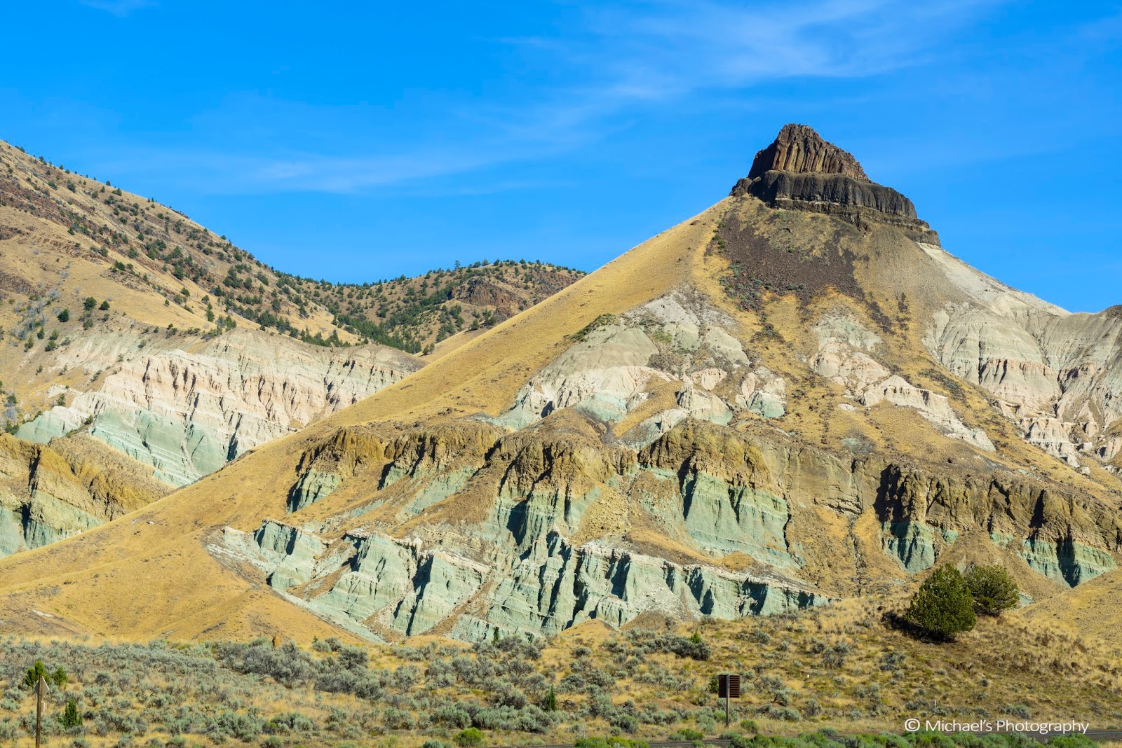
John Day Fossil National Monument (NM)
The John Day Fossil NM is the one of the best places to watch the total solar eclipse - it stays in the half-desert area in the eastern Oregon, has rich fossil rocks, beautiful landscapes, clearest sky along the totality's path.
I picked Sheep Rock unit/Thomas Condon Paleontology Center as my destination, since I also wanted to visit two photographic places near Mitchell - Blue Basin and Cathedral Rock.
Here is my round trip planning from Seattle to Sheep Rock/Painted Hills near the small town of Michell in the eastern Oregon:
 |
| Round Trip Driving Direction, 08/2017 |
 |
| Ranch on the way to Mitchell OR, 08/2017 |
During the solar eclipse event, the ranchers in the areas open their ranches as the temperament camping sites. This relieved the headache in finding the suitable camping sites. Mine is next Foree trailhead, 3 miles north of Blue Basin.
 |
| Total Solar Eclipse Time: 2 min 5 sec, 08/21/2017 |
Here is our camping site, photoed by Routers' reporter Adrees Latif:
 |
| Bull Canyon Ranch (36603 Hwy 19, Kimberly, OR) Camp Site, 08/2017 |
Here is the night scene of our camping site:
 |
| Milky Way shot in the camp site, 08/2017 |
 |
| Milky Way shot up the hill next my camp site, 08/2017 |
 |
| Milky Way shot up the hill next my camp site, 08/2017 |
I could also enjoy the color rocks in my camping site across the John Day river:
 |
| Colorful rocks view from my camping site, 08/2017 |
 |
| Colorful rocks view from my camping site, 08/2017 |
During the three days' stay, I visited a couple of places, which represented different rock colors and formations.
Foree Trailhead (GPS: 44°39.124' N 119°38.413' W)
The trail head is just 500 feet next to my camping site. So I took the chance to walk two short trails there - Story in Stone Trail and Flood of Fire Trail. They are beautiful places to visit and good for the family walk there as well.
 |
| Foree basin is ahead, 08/2017 |
 |
| Foree basin, 08/2017 |
 |
| Foree basin, 08/2017 |
 |
| Walk up the Flood of Fire trail, 08/2017 |
 |
| Close across viewed from the end of Flood of Fire trail, 08/2017 |
Blue Basin Overlook (GPS: 44°35.728' N 119°37.858' W)
Blue Basin is just 4 miles north of Thomas Condon Paleontology Center. There are two trails in this place, part of the John Day Fossil Beds – Sheep Rock Unit. They are managed by the National Park Service. The Blue Basin Overlook Trail is one of the most colorful spots in Central Oregon, which is 3-mile loop trail is strenuous in spots, hot in the summer and beautiful to behold.
Another short 1 mile trail takes you to the interior of this iconic natural formation, i.e. Island in Time. It's totally worth the time to visit.
 |
| Heading up the Island in Time, 08/2017 |
 |
| Heading up the Island in Time, 08/2017 |
 |
| Inside the Blue Basin, 08/2017 |
Cathedral Rock (GPS: 44°37.832' N 119°38.679' W)
Cathedral Rock is another interest spot 1 mile north of Blue Basin, which causes John Day river to make a 90 degree turn:
 |
| Cathedral Rock, 08/2017 |
Early morning is the good time to visit and shoot - the sun is high enough to light up the rock and the surrounding area:
 |
| Cathedral Rock and John Day River viewed from northeast. 08/2017 |
 |
| Photoed at Cathedral Rock by Routers' reporter Adrees Latif, 08/2017 |
Sheep Rock (GPS: 44°33.158' N 119°38.782' W)
The Sheep Rock unit is one of the three units in John Day Fossil NM. The Sheep Rock is just opposite to the Thomas Condon Paleontology Center.
 |
| Sheep Rock Unit, 08/2017 |
 |
| Sheep Rock in John Day Fossil NM, 08/2017 |
 |
| Remote view of the Sheep Rock along the John Day river, 08/2017 |
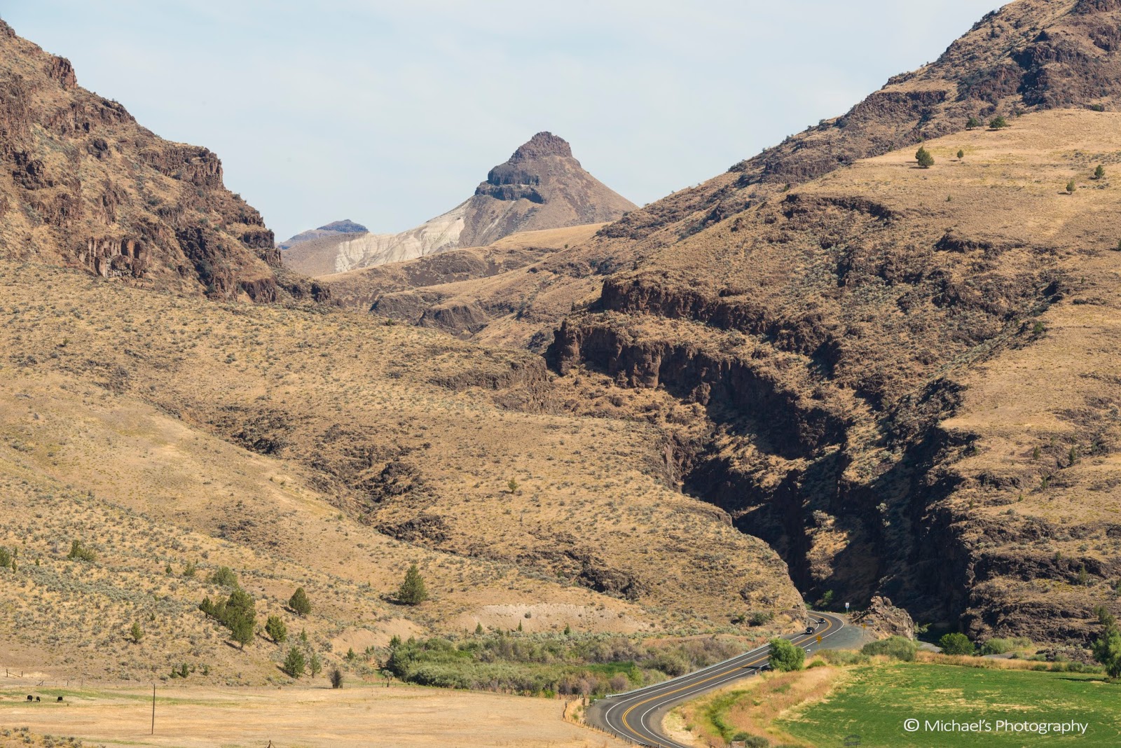
Picture Gorge
You can drive few miles south from Thomas Condon Paleontology Center and will meet hwy 26, which runs from west to east. Then turn left to hwy 26, you will see the Gorge ahead of you. From here you can drive 9 miles to the town of Dayville.
 |
| The north entrance of the Picture Gorge stays on the left ahead |
 |
| South entrance to the Picture Gorge from Dayville OR, 08/2017 |
 |
| Picture Gorge view from Mascall Formation Overlook, 08/2017 |
The gorge's name came from the pictures drawn in the Gorge by native Indian people long long time ago. On the way to Dayville, you can turn right to Antone Hwy to drive up to the Mascall Formation Overlook to see the overview of the Picture Gorge and the John Day valley area:
 |
| Mascall Formation view from the Hwy 26, 08/2017 |
 |
| John Day valley viewed from from Mascall Formation Overlook, 08/2017 |
 |
| Picture Gorge view from Mascall Formation Overlook, 08/2017 |
Painted Hills Unit (GPS: 44°38.992' N 120°16.006' W)
The Painted Hills is one of the three units in John Day Fossil NM. It's always fascinating places to visit all year around, especially September and February.
 |
| Painted Hills, John Day Fossil NM, 08/2017 |
 |
| Painted Hills, John Day Fossil NM, 08/2017 |
 |
| Painted Hills, John Day Fossil NM, 08/2017 |
 |
| Painted Hills, John Day Fossil NM, 08/2017 |
 |
| Painted Hills, John Day Fossil NM, 08/2017 |
 |
| Sunset moment in the Painted Hills and surrounding area, 08/2017 |
 |
| Sunset moment in the Painted Hills and surrounding area, 08/2017 |
Enjoyed the solar eclipse
My camping site is 1 mile north from the eclipse center. The eclipse started at 9:08 a.m., ended at 11:44 a.m. The total solar eclipse at my camping site last about 2 minutes 5 seconds.
 |
| Solar Eclipse in progress, 08/21/2017 |
 |
| Solar Eclipse in progress, 08/21/2017 |
 |
| Solar Eclipse in progress, 08/21/2017 |
 |
| Near the moment of total solar eclipse, 08/21/2017 |
Totality of solar eclipse
While the totality approaching,the surrendering air temperature started dropping. Everyone held the breath and was very quiet. All sounds were not felt at all. It looks like the moment of world end. The day became dim, dim, and dimer. All lights were suddenly gone.
I strongly felt the inner peaceful moment. The world was so quiet, everyone looked up to the sun. A moment later, I heard the applaud. The totality ended. It was such a short moment. I felt I hadn't started the joy yet!!!
I checked my photos, and they recorded the duration: 2min 5sec.
 |
| Totality of solar eclipse, 08/21/2017 |
 |
| Totality of solar eclipse, 08/21/2017 |
 |
| Out of total solar eclipse, 08/21/2017 |
 |
| Out of total solar eclipse, 08/21/2017 |
 |
| Out of total solar eclipse, 08/21/2017 |
 |
| Near the ending of the solar eclipse, 08/21/2017 |
 |
| Overview of the solar eclipse, 08/21/2017 |
Trip ends
The sun rises again on the next day over the Umtanum ridge, Yakima. It's still as normal!
 |
| Sunrise over the Umtanum ridge, 08/2017 |