Wednesday, August 9, 2017

Summer photography trip to Mt Rainier

This year I squeezed time to join the photography trip to Indian Hunting Ground for summer flowers. I took one more day to visit other places near the Paradise Visitor Center, Mt Rainier National Park.

I had two night camping reservation on Cougar Rock camping ground, which is just 2 miles inside the park east of Longmire visitor center/museum.

Mazama Ridge


Mazama Ridge Trail and little Tacoma, 07/29/2017

Mazama Ridge Trail and Tatoosh Range, 07/29/2017

Paintbrush on the Mazama Ridge Trail, 07/29/2017


Flower on the Mazama Ridge Trail
07/29/2017

Paintbrush on the Mazama Ridge Trail
07/29/2017


The Pinnacle Saddle

I arrived afternoon on July 29. After I setup my tent and had a moment rest, I drove to the Reflection Lake. Then I headed up to the trail of Pinnacle Saddle. It was just 1.3 miles from the trail head, but I measured it was over 2 miles. The hiking was just average, and felt little bit strenuous only in the last three switches after passed through about one (1) miles forest.

Trail head to Pinnacle Peak, 07/29/2017

The end of the trail is the boundary of the Mt Rainier NP. Here is a good place to have a break and enjoy the Mt Adam on the south, the Castle Rock on the east side.

Pinnacle Peak Saddle Trail, Mt Rainier NP, 07/30/2017

From the end of the trail, I took the trail along the ridge on the right, walked about 10 minutes, and arrive the destination - a small pond with the beautiful view of the Mt Rainier on the north. 

Here is the good place to shoot the Sunset and Sunrise. The last 15 minutes before the Sunset, 30 minutes before the Sunrise. Because of heavy snow last year, and high temperature recent few weeks, the snow hasn't melted, and pond has just little water.

Mt Rainier viewed near Pinnacle Saddle, 07/30/2017

In order to take another Sunset photos in the Saddle, I had to left 15 minutes before the Sunset got back in 10 minutes to have a beautiful picture of Mt Rainier with Pinnacle Peak wall on the right.

Viewed Mt Rainier from Pinnacle Saddle, 07/30/2017

The Reflection Lakes

Reflection Lakes are one of the most photographed view of the Mt Rainier. I includes two small lakes. The Mazama Ridge trail starts on the east lake. The lakes are bordered with wildflowers in the summer, the fall color come back in Autumn as well.

Mt Rainier reflected in the Reflection Lake, 07/31/2017

Thistle in the Sunrise, 07/31/2017

Enjoying the Sunrise in the Reflection Lake, 07/31/2017

Indian Hunting Ground via Kautz Creek

This is about 13 miles' trail, staring on Kautz Creek trail head, pass through Indian Henry's Hunting Ground, and arrive at Mirror Lake underneath of Mt Rainier. The Kautz Creek TH is about 4 miles west of Longmire visitor center.

Trail to the Indian Hunting Ground/Mirror Lake
07/31/2017

Meadow of the Indian Hunting Ground, 07/31/2017

Meadow of the Indian Hunting Ground
07/31/2017

Junction between Indian Hunting Ground trail and
Wonderland Trail, 07/31/2017

Mt Rainier Reflected in the Mirror Lakes
07/31/2017

Mt Rainier Reflected in the Mirror Lake
07/31/2017

Meadow of the Indian Hunting Ground
07/31/2017

Meadow of the Indian Hunting Ground
07/31/2017


The Bench Lake

The Bench Lake is just few miles east of Reflection Lake. I started the hike from the Snow Lake TH at 5:10am, and arrived at in 17 minutes at the moderate pace. 

You can follow the trail to go another 0.3 mile, you will be in the Snow Lake, which is another alpine lake under the Unicorn Peak.


Because of the heavy snow last year, the lake is pretty full, not much beach patch available. The first beam light was pretty awesome - green trees, magnificent Mt Rainier, beautiful reflection.


First sunlight on Mt Rainier at in the Bench Lake

Off course you can wait until the side and front trees are lighted up:

Sunrise of Mt Rainier at the Bench Lake


Monday, May 29, 2017

Visit the Grays Harbor National Wildlife Refuge near Ocean Shores WA


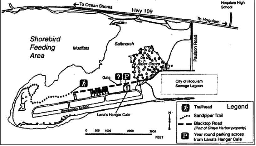
Grays Harbor National Wildlife Refuge (NWF) is located of within Grays Harbor, 18 miles east of Ocean Shores, which makes up the second largest watershed in Washington. It's one of 4 major staging areas for migrating shorebirds in the Pacific Flyway. Every year, up to one million shorebirds gather here in spring anf fail to feed and rest.

Location GPS: (46.973932, -123.930611)


Trail and the views in Grays Harbor NWF

There is one mile wood trail get close to the wet lands, where you can watch the migration birds closely. In this memorial day long weekend, we stopped here on way to Ocean Shores recreation park.


Grays Harbor NWF and the parking lot


Walked on the trail, we found quite a few birds, but not many as expected. Now most of the migrant birds should have flown away to the north.

Very cute bird singing far away

Two blue herons play around

Two blue herons play around


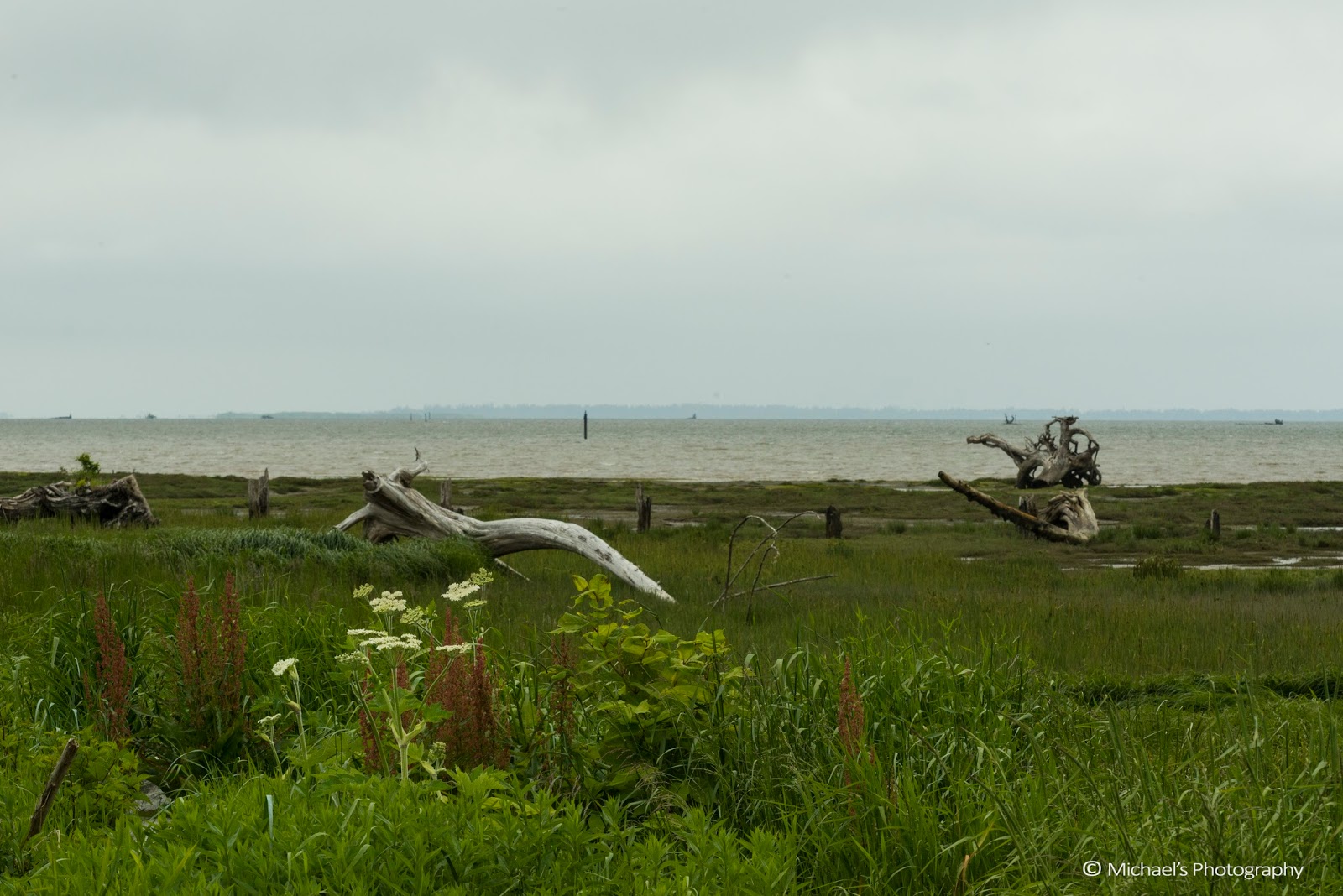
Wet land and Ocean Shores far away to the west viewed from the end of the trail

Wet land and the tree standing on top of dead tree

Wet land and the tree standing on top of dead tree (viewed near by the entrance door)

Saturday, October 8, 2016

Traverse the Upper Enchantments


The Enchantments

I didn't win the lottery for the camping permit to the Enchantments. The season was kind of late, the color in the Easton Pond was already dark, but there should still be some color in the Enchantment basin since there were not snowing there yet. 

So I decided to do daily traverse from Colchuck Lake to the Lower Enchantments via Aasgard Pass. My friend and I would turn back as late as 2:00 pm so as to climb down Aasgard Pass to the Colchuck Lake before 5:00m. 

The first three weekends in the Leavenworth are Autumn Festival. We arrived at Eight Mile Camping Ground early afternoon to secure the camping spot. Then we enjoyed the afternoon and night life in the beautiful town of Leavenworth.

Easton Pond along I-90 at Exit 70, 10/08/2016

Falls Colors at Leavenworth, WA, 10/08/2016

Falls Colors at Leavenworth, WA, 10/08/2016

Autumn Festival at Leavenworth, WA, 10/08/2016

The Colchuck Lake/Aasgard Pass

We got up at 4:00am and started the trip on the Colchuck Lake trail head at 5:00am. It was still very dark, but the 5.5 miles trail to the Colchuck Lake is pretty straight forward, and arrived there about 7:40am. The pace was little slow, and we didn't catch the moment of the Sunrise. The weather is good to climb up the Aasgard Pass.

Colchuck Lake, WA, 10/09/2016

The Aasgard Pass was snow free and there existed some Larch Tree, with golden color. As usual, it takes about one hour at least to detour the lake and cross over the boulder area.

Aasgard Pass, WA, 10/09/2016 

We were not alone. We climbed with other few folks up the Pass and enjoyed the beautiful view of Colchuck Lake.
Climbing the Aasgard Pass, 10/09/2016

Larch Tress on the Aasgard Pass

The Enchantment Basin

Isolation Lake, WA 10/09/2016

Isolation Lake, WA 10/09/2016

Lower Enchantments, WA 10/09/2016

Lower Enchantments WA 10/09/2016

Lower Enchantments and Little Annapurna, 10/09/2016

Enchantment Basin, WA 10/09/2016

Inspiration Point

This was the last spot before turning back.

Perfection Lake and Prusik Peak WA 10/09/2016

Friday, September 23, 2016

Trekking to the Picture Lake, Mt Baker


There are lots of photography opportunities during the Fall season in the Mount Baker area. This is my first trip to Mt Baker to take a chance and to stay at the Seattle Mountaineers lodge at Mt Baker. The place is very cozy, and the volunteers prepared a very good meal.

My plan was to stay there two nights, and take some pictures near the Picture Lake, Artist Point, and pick up some trail to walk around. Unfortunately the weather is not good, and I took just few good shots.

The Picture Lake

The Picture Lake is an iconic place to shoot Mount Shuksan, and it's reflection in the lake. But it was cloudy, and even rained some time. Here are some pictures during Sunset and Sunrise moment.


Sunset in the Picture Lake, 09/23/2016


Foggy Morning in the Picture Lake, 09/24/2016


Mt Shuksan and Picture Lake, 09/24/2016


Sunset moment in the Picture Lake, 09/24/2016


The last color of the sunset in the Picture Lake, 09/24/2016

Table Mountain Trail

Table Mountain Trail is a 3.9 mile moderate trail, starting from the parking lots in the Artist Point.  trafficked. It's a very good trail to relax for hiking, walking, and trail running from July until October.

Table Mountain Trail and surroundings


Even though it was very cloudy, but there are few chances that the Mt Baker and Mount Shuksan loomed.

Mt Baker, 09/24/2016


Mt Baker, 09/24/2016


Mt Shuksan, 09/24/2016