About the Ancient Lake
Ancient Lake is in the Patholes Coulee - a recessional-cataract canyon. It was caused by the Missoula Floods, the cataclysmic floods that swept periodically across this area and down the Columbia River Gorge, eventually into the Pacific Ocean at the end of the last Ice Age.The Missoula glacial lake outburst floods were the result of periodic sudden ruptures of the ice dam on the Clark Fork River that created Glacial Lake Missoula. After each ice dam rupture, the waters of the lake would rush down the Clark Fork and the Columbia River, flooding much of eastern Washington and the Willamette Valley in western Oregon.
- Glacier Lake Missoula
- Clark Fork River Valley
- Camas Prarie
- Channeled Scablands
- Dry Falls
- Flood Debris
- Erratics
- Temporary Lakes
- Columbia River Gorge
There are few small lakes in this Coulee, such as Ancient Lake, Dusty Lake, Quincy Lake, Burke Lake, and etc. Ancient Lake is the best place to set up an overnight camp, it is just 2.5 miles' walk from the trail head, without much elevation gain. Along the way there are several side trails that lead to the top of a basalt blade that separates the dual-cataract canyon.
Every year April to June is the best time to exploring Ancient Lakes in the Quincy Wildlife Recreation Area. Usually during this time, it's sunny and warm, which make it easier for you to pitch your tent by a lake.
Preparation
Since the water in the lake and nearby are from agricultural and other purpose. It may contain the chemical. So you need to bring enough water for drinking, coking, and etc. Usually you need to bring at least 5 liters water for one night camping. On the hot days, you may need to bring more. Since you just need to hike over 2 miles from trail head to the camping ground, so the load shouldn't been an issue for you. Off course you can bring some luxury gears, such as chairs.
Start the Hike
We arrived at the TH at 10:40 am and started the trip about 11:00 am. But today it was cloudy with isolated rain drops though, but it's good for hiking without worrying too much about sweating.
 |
| Heading to the Ancient Lake |
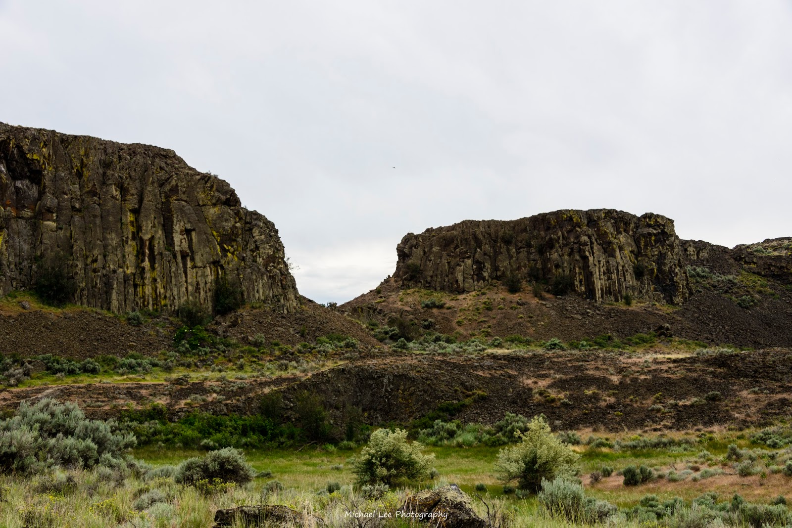
We started the hiking along the old jeep road to the east up the Coulee through sage and cactus, rising ever so slightly. A huge boulder tumbled from the cliff above provides the only shade on the hike.
 |
| The erratic rock remembers the history of the super flooding |
Over half a mile, you will notice the first slim waterfall pouring down into the deep Coulee, where you can take a water break and enjoy the beauty of the grand view in the whole Coulee. You can see the ring cliff in the valley. To continue the hiking, you will see the fork. You can take either left or right. But the road will be little flat if you take the right road, which is kind of Jeep road. We took the left one and took the right one returned to trail head the next day.
About 1 hour and 15 minutes, you should be close to the Ancient Lake, where you will see three small lakes stand near each other. After you arrived at the upper hill, you will see another bigger waterfall on the east Ancient Lake. You can continue the trip upper the hill and then stay between the two lakes. You can cross them and see the third small lake on the south.
 |
| Viewed from the south side of the Ancient Lake |
 |
| Ancient Lake and the waterfall |
Cmping Sites
There are lots of camping spots you can choose. We set up our tent by 2:00pm, and prepared our lunch for an hour. It's still cloudy, but fortunately the temperature was still good for our next exploring destination - the Dusty Lake.
 |
Ritu and Ashish are setting their tent
|
Dusty Lake Exploration
It took us about one hour to arrive at the top hill, where we can take a look at the lake. The Dusty Lake is much bigger than the Ancient Lake.
It took use about 30 minutes back to the Ancient Lake by taking the short cut, instead of the rock scramble.
 |
The view of the coulee. The Lake is on the other side
|
The Ancient Lake
After back from the Dusty Lake, we explored the Ancient Lake by hiking up to the waterfall, where you need a few yards' rock scramble. The waterfall is the main water source of the Ancient Lake. It come from the upper area where lots of farms produce fruit and other crops. There may have another trail ends on the top of the waterfall. From top of the waterfall, you should be able to bird view the whole Ancient Lake area.
Directions
Take I-90 east to exit 149, SR 281. Go north towards Quincy. After 5.6 miles turn left on White Trail Road, and follow that 7.8 miles to road 9-NW. Continue 5.9 miles on this road (it drops onto a bench and doubles back to the south). Park in the parking area at the end of the road.